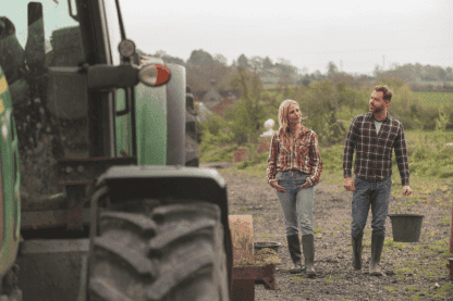
Farm management and crop production
FarmPortal is a comprehensive, intuitive system for any farm.
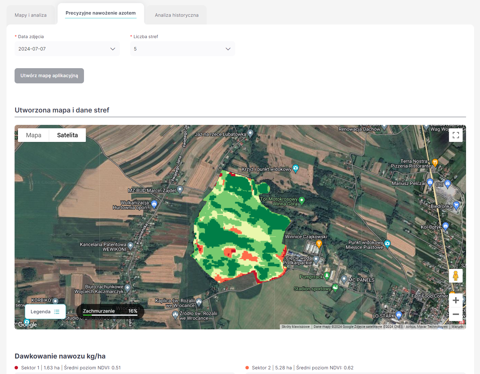
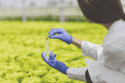
Precise Fertilization
The application analyzes soil test data and satellite images to create personalized fertilization maps that deliver the optimal amount of nutrients for each area of the field. Reduce fertilizer usage, lower costs, and protect the environment.
Fertilization Calculator
Satellite imagery
Soil Testing
Fertilizer Database
Crop Safety
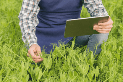
Monitor crop conditions in real time. FarmPortal provides detailed information on plant status and identifies areas that require additional attention. This allows you to respond quickly and effectively, increasing yields and minimizing losses caused by diseases or adverse phenomena.
Crop Assistant
Disease models
Spraying recommendations
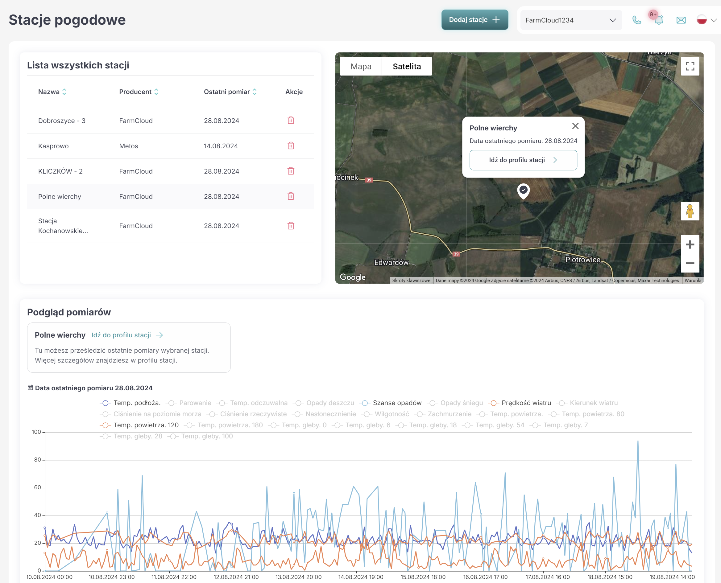
Weather stations, soil moisture sensors
Cooperation with an advisor
Frost alerts
Farm Management
Effective farm management requires good organization, access to current information, and continuous monitoring of resources. FarmPortal is your ERP system:
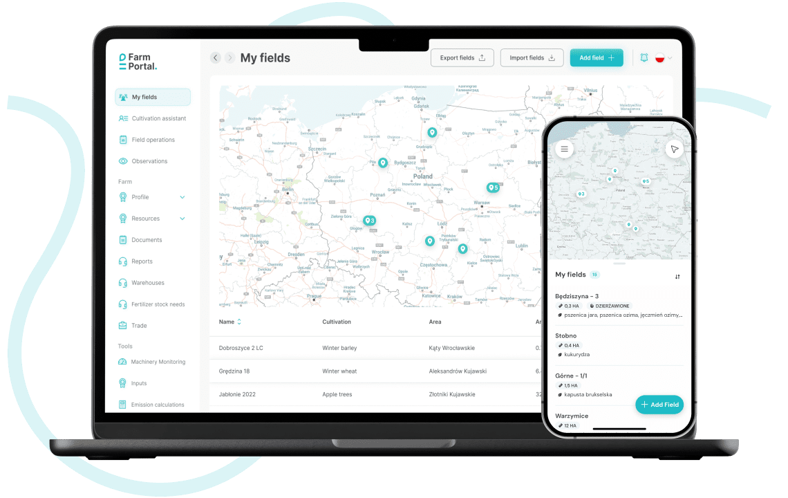
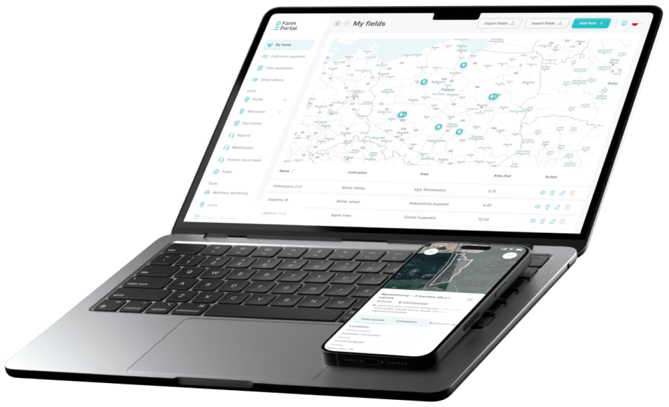
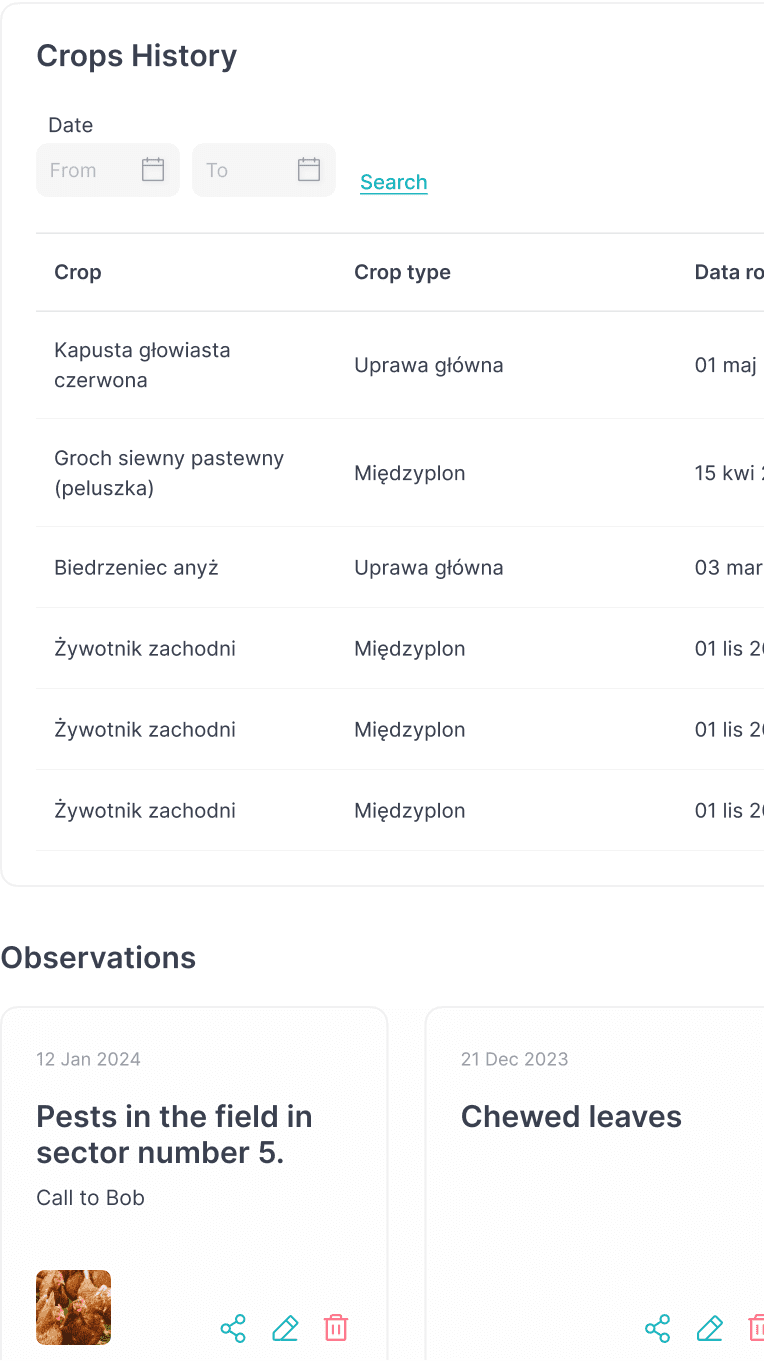
Detailed list of fields and crops
Work and harvest registry with settlements
Cost and treatment register
GPS-based machine management, service, and documentation
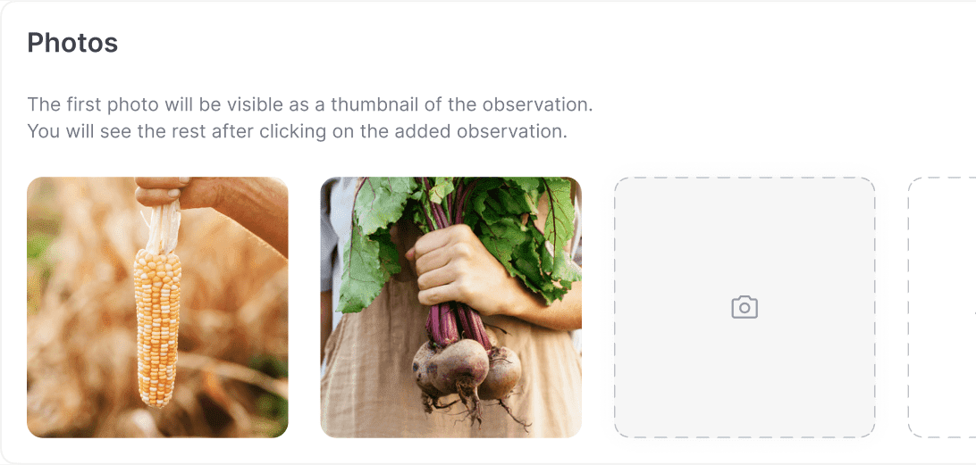
Warehouse management, field observations, buildings
For 4 years, we have been delivering modern solutions for the agri-food industry, supporting sustainable agriculture, shortening supply chains, and increasing the profitability of agricultural production.
to
Save on fertilizers thanks to precise calculations, soil testing, and satellite imagery – your yields are within reach!
to
More effective plant protection with recommendations on treatment timing, precise weather forecasts, and a comprehensive pesticide database.
to
More efficient farm management using Agriculture 4.0 solutions, reports, and analyses.
Created for the agricultural industry
Agricultural Producers
Whether you operate a small, medium, or large farm – our application is designed for you! Choose free features tailored to your needs and manage your crops like a professional!
Orchardists and Fruit Growers
Forget about lengthy notebooks and scattered information. Manage your orchard business efficiently with an application that organizes your data and helps you focus on what matters most: cultivation.
Technology Companies
Do you have technological solutions that are revolutionizing agriculture for the better? Contact us; we will help with implementation.
Consultants
Do you work with farmers and are you seeking tools for direct support? FarmPortal and FoodPass are the answer to your needs.
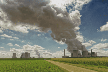
Sustainable Production
Soil Protection
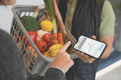
Shortening the Supply Chain
Everything you need to manage your farm
Agriculture 4.0
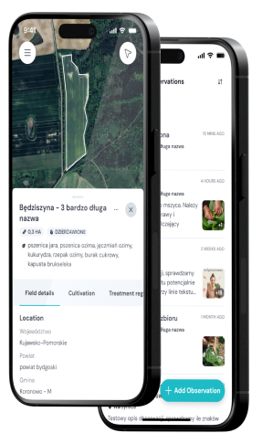
Fields and Crops
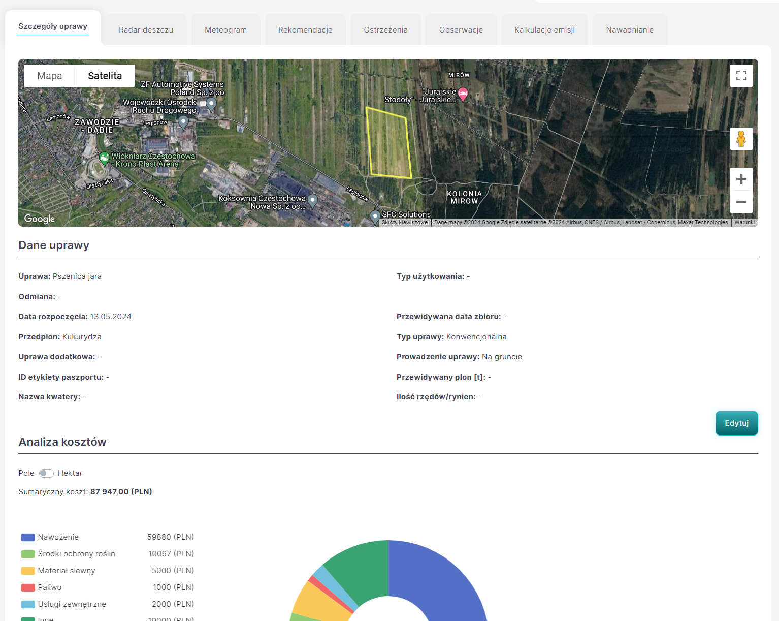
Detailed records of land, crops, and agronomic treatments. All crop information in one place.
Crop Monitoring
The crop assistant continuously provides information on crop condition, irrigation, costs, and recommended treatment schedules.
Farm Management
Efficient farm management using telemetry, weather stations, microclimate sensors, and management of employees, machinery, and inventory.
Sustainable Agriculture
Care for your soil and improve its productivity. Adjust fertilization to the real needs of your farm while protecting your financial balance.
Carbon Consultancy
FarmPortal calculates CO2 and nitrogen emissions, enabling you to identify areas for improvement and implement changes for sustainable agriculture.
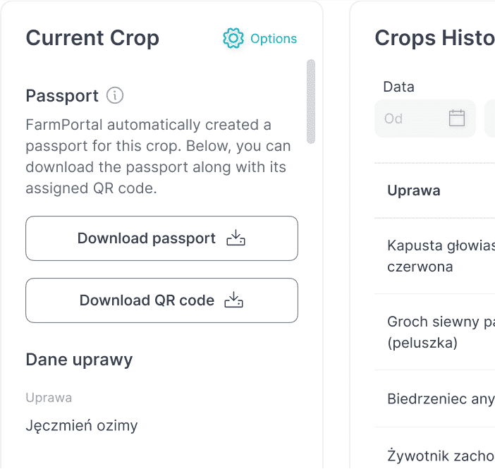
Passportization
Shorten the supply chain and build your brand based on the generated product passport. Collect certification documentation, e.g.: for GlobalGAP.

Schedule a Presentation
We want to understand your needs and answer your questions.

Created for the agricultural sector

![]() By creating NDVI maps, I precisely apply fertilizers exactly where needed. I use less fertilizer while maintaining yields.
By creating NDVI maps, I precisely apply fertilizers exactly where needed. I use less fertilizer while maintaining yields. ![]()
Jan Kępa
Polski Instytut Truskawki
Harvests and settlements are much easier. Reports summarize the harvesters and the plantation; we can also monitor the quality of the produce in each crate.
Brodowski Owoce
Precise weather measurements and frost alerts helped me save a blooming orchard from losses.
Michał Sztyga
Using FarmPortal, I manage daily tasks related to planning employee work and monitoring their performance more quickly. Thanks to the observation feature, I always know what is happening in the field.
FoodPass for processors and distributors of fruits and vegetables, agricultural consultancy, and agronomists. It enables direct collaboration with growers, digitization of quality and safety control processes for agricultural products, contract management, remote and on-site consultancy, and sample collection.
AgroSell – a trading platform for the distribution of agricultural inputs, services, and products.
Agri Insights – dedicated reports and predictive analyses for the agri-food industry.
- Weather stations
- Agricultural navigations with automatic control
- GPS trackers for monitoring position, field work, and reporting
- Sensors for monitoring storage conditions
- Soil moisture sensors
Bogdan Dobrosiewicz
I enter all the relevant information into the application instead of writing notes on paper. This makes it easier for me to make subsequent decisions and settle accounts with ARiMR.