Zdobądź nawet 200 000 zł na ochronę środowiska
Inwestycje przyczyniające się do ochrony środowiska to wyjątkowa okazja na zakup czujników, maszyn i urządzeń rolniczych oraz oprogramowania.
O naborze
For whom?
- Rolnik indywidualny,
- Grupa rolników (min. 3),
- Brak dolnego limitu powierzchni,
- Maksymalna powierzchnia zakwalifikowanego gospodarstwa to 300ha.
Wielkość i rodzaj wsparcia
- do 80% kosztów kwalifikowalnych operacji (grupa rolników),
- do 65% kosztów kwalifikowalnych operacji lub do 65% ustalonych kosztów jednostkowych (rolnik).
- Minimalna wartość wnioskowanej kwoty wynosi 20 tys. zł.
- Maksymalne wsparcie wynosi 200 tys. Zł.
Na co można przeznaczyć środki:
- Technologie do aplikacja nawozów z wykorzystaniem rozwiązań cyfrowych,
- Technologie poprawiające gospodarowanie wodą,
- Budowę lub zakup elementów infrastruktury technicznej pod kątem Adaptacji do niekorzystnych warunków pogodowych,
- Systemy wspomagania decyzji (DDS).
Kryteria wyboru mogą w szczególności obejmować:
- skalę lub rodzaj produkcji prowadzonej w gospodarstwie rolnym,
- zastosowanie rozwiązań cyfrowych,
- operacje realizowane przez grupę rolników, tj. wspólnego użytkowania zakupionych nowych maszyn i urządzeń (umowa zawarta pomiędzy co najmniej trzema rolnikami będącymi osobami fizycznymi),
- poprawę efektywności wykorzystania nawozów,
- zmniejszenie zużycia lub poprawę efektywności wykorzystania środków ochrony roślin,
- poprawę gospodarowania wodą,
- poprawę sekwestracji węgla lub bioróżnorodności gleby,
- położenie gospodarstwa na obszarze Natura 2000.
Get up to PLN 200,000 in funding under
- Agriculture 4.0, or
- Investments Contributing to Environmental Protection
Offer
All of the products listed below are eligible expenses covered by the support.
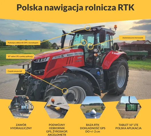
Automatic Navigation
With the grant, you can modernize and streamline your machinery fleet. Take advantage of this opportunity to install GPS navigation with automatic control:
- Two-way communication with the FarmPortal / FarmCloud system – a requirement for Agriculture 4.0
- RTK accuracy up to 2.5 cm
- Dual GPS receiver with gyroscope
- Hydraulic control
- Field mapping
- Technological paths, virtual crossovers
- Turn automation
- Tractor performance parameter logging (mapping hydraulic inputs)
- Fuel consumption, engine RPM
- Performance statistics (by area and/or time)
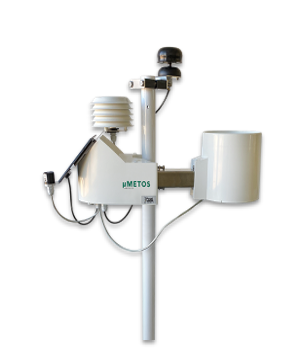
Weather stations and irrigation
Weather stations from renowned manufacturers integrated into FarmPortal allow you to:
- optimize field operations (plan sowing, fertilization, spraying, harvesting) based on weather conditions
- increase treatment efficiency by adjusting to atmospheric conditions
- minimize the risk of ineffective spraying
- possibility of integration with irrigation systems
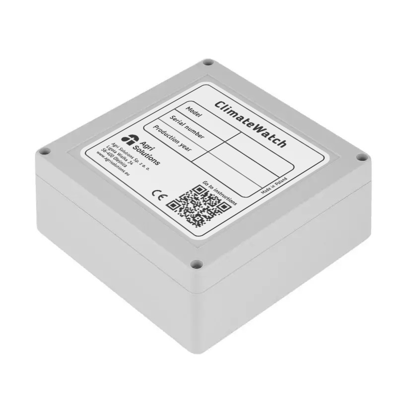
Storage sensors
Monitor storage conditions for fruits and vegetables in real time:
- maintain optimal conditions to slow down ripening and decay
- minimize losses caused by improper temperature and humidity
- enhance product quality
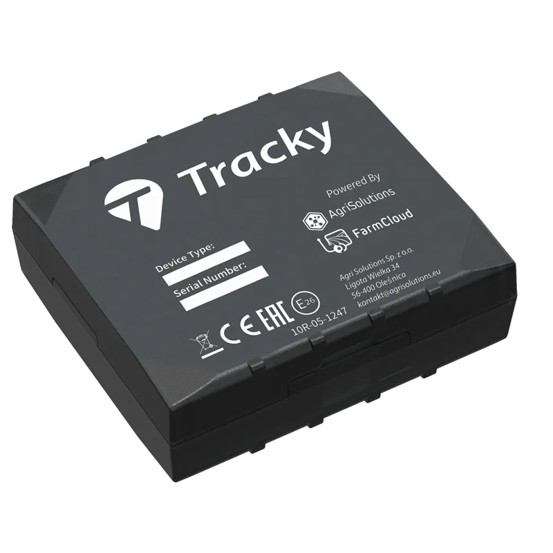
Machine GPS Monitoring
Monitor machine and vehicle operations in real time, and better manage work schedules:
- CAN data reading from tractors and other machines
- GPS position monitoring and machine operation reporting
- actual fuel consumption and level, total mileage, temperature, and other engine parameters
- generation of alerts and alarms in FarmPortal
FarmPortal Application
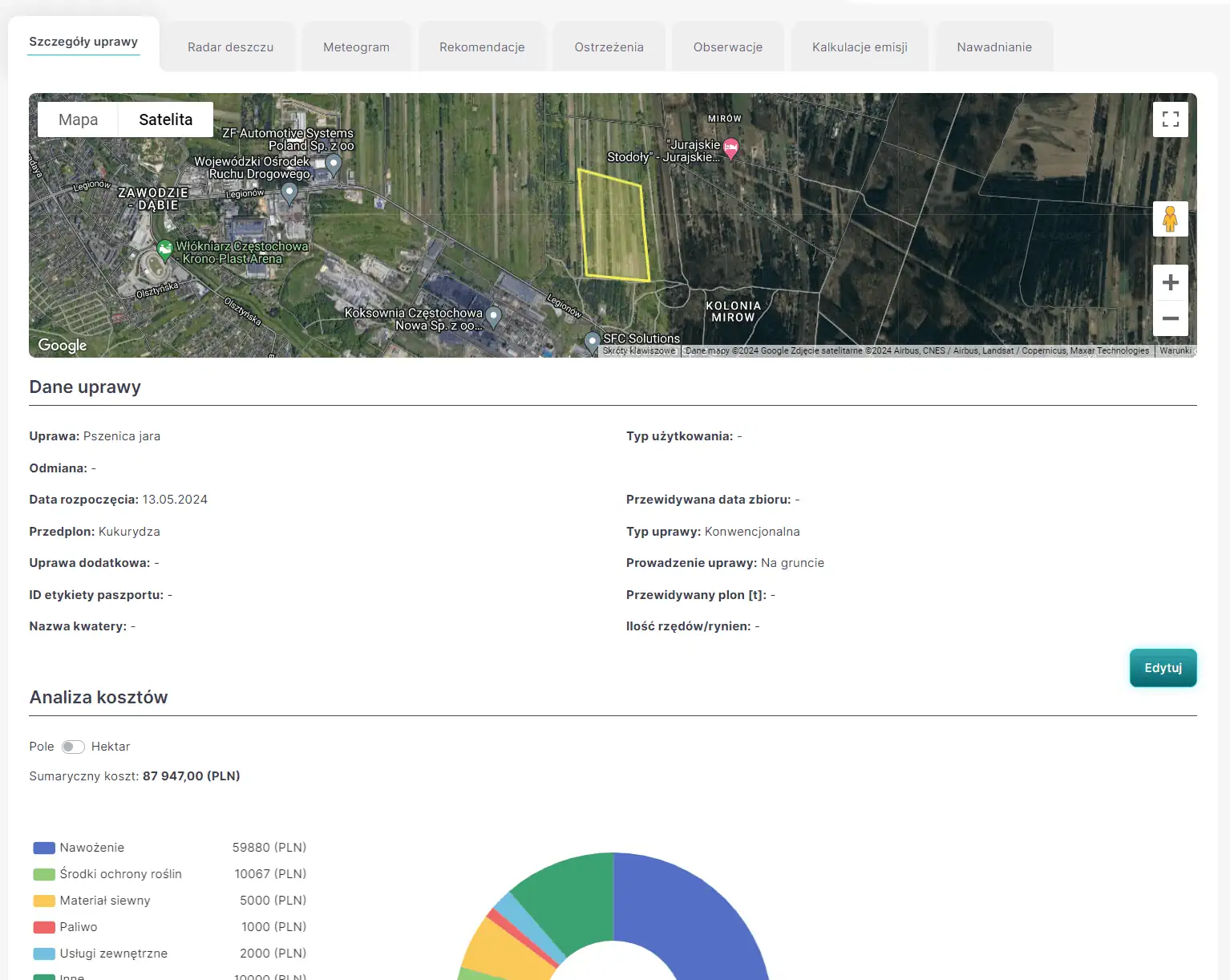
A comprehensive system for farm management and crop condition monitoring. Features in line with funding requirements:
 modele chorobowe
 - zdjęcia satelitarne
- system wspierania decyzji (DSS) – pomiary z czujników lub bazy danych, dają rolnikowi niezbędną informacje do podjęcia decyzji o zastosowaniu zabiegów:
- Irrigation – supports the farmer by providing information on when and how much to irrigate, and warns of potential drought. Integration with sensors;
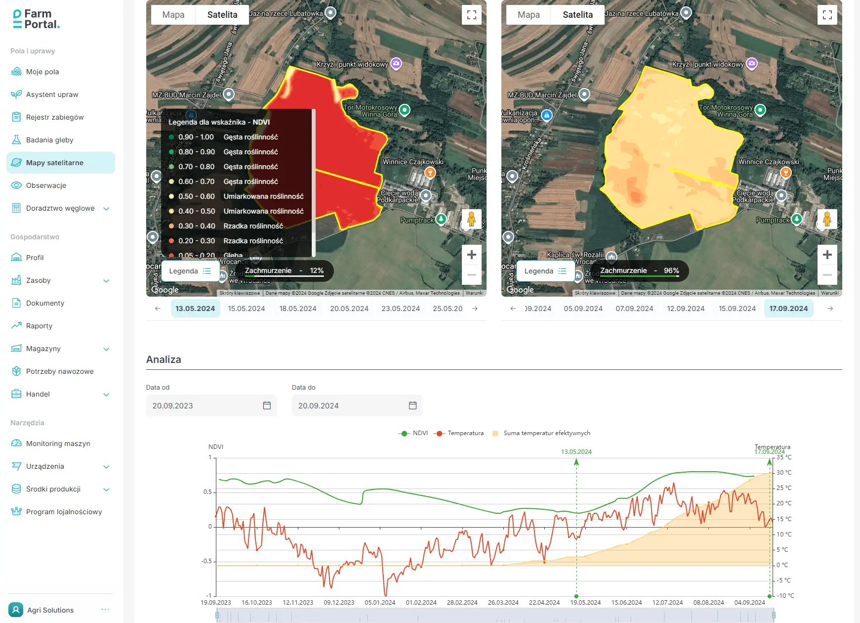
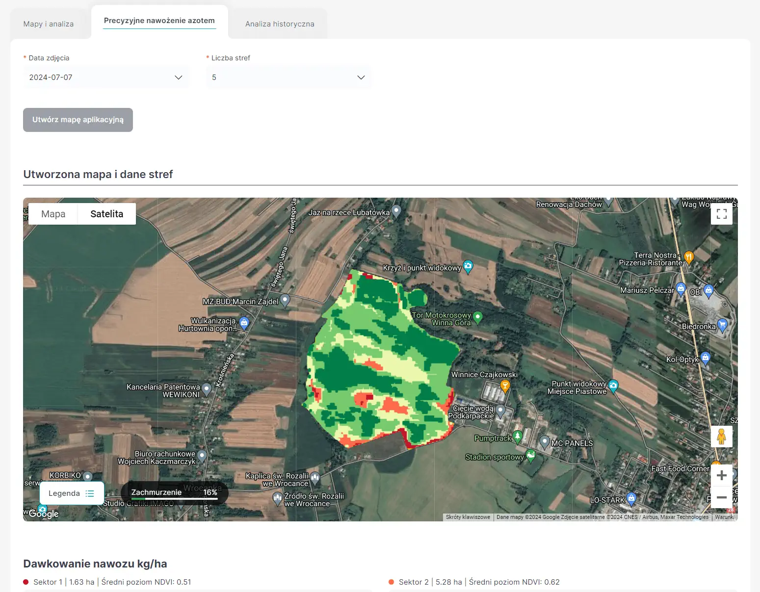
- Fertilization – enables the development of a long-term fertilization plan based on soil fertility maps, crop requirements, and sensor data. Short-term – a system that calculates vigor indices (NDVI) from satellite images and recommends fertilization doses. Supports exporting fertilization maps to spreaders;
- Plant Protection – a database of diseases and crop protection products. Disease models with alerts. Scheduling of spraying operations.
- system zarządzania gospodarstwem (FMS) – moduły:
- decision support;
- automatic report generation: carbon footprint, water footprint, food passport, water consumption per ton of yield, and more;
- analysis of farm data, e.g., labor intensity and cost of operations – these modules facilitate effective advisory services and decision-making to improve production economics or to properly select investments in machinery and buildings;
- storage; inventory and recording of machine operating hours;
- mapping for field mapping, precision agriculture supporting the creation of fertility maps or irrigation zones, work time, and task assignment for employees, sensors.
Partners
Looking for assistance with your application? Want more information? Contact our partners!