From Pixels to Decisions: Vegetation Indices and Variable-Rate Fertilization in FarmPortal
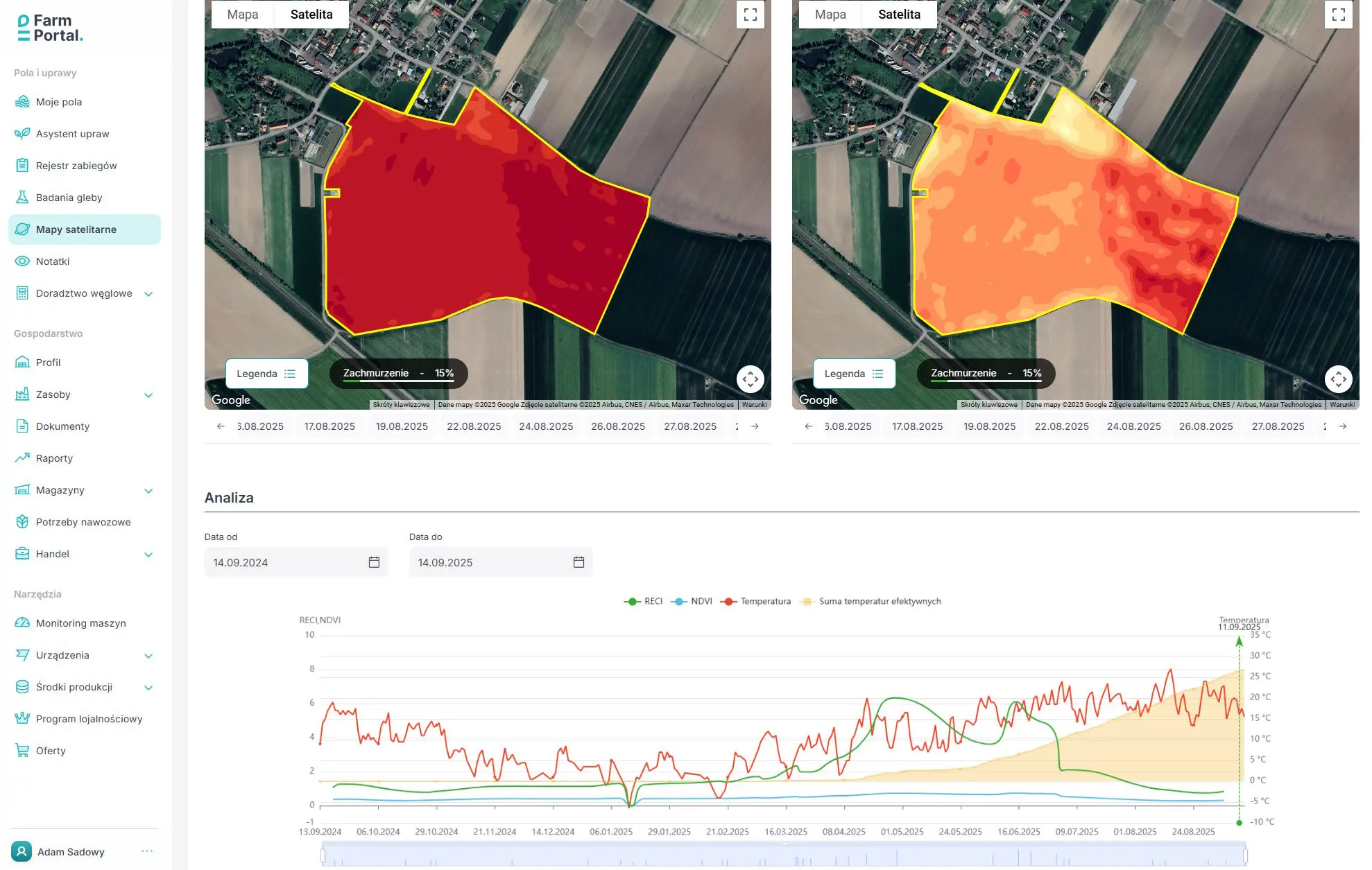
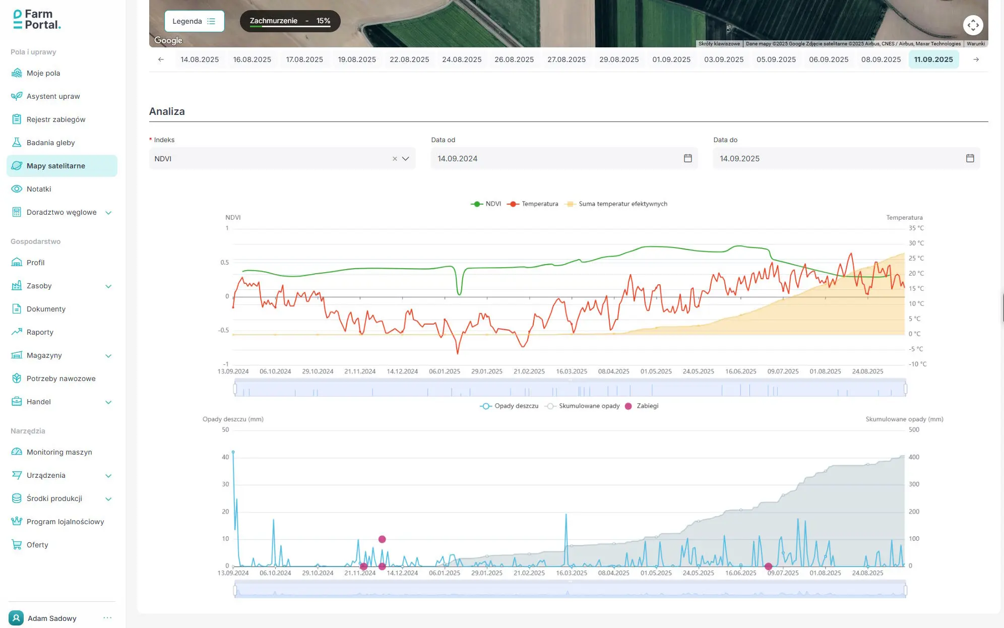
Vegetation indices (e.g., NDVI, NDRE, RECI, MSAVI) convert spectral data from satellites, drones, and in-field cameras into concise indicators of crop status. They turn “raw” pixels into information about chlorophyll, biomass, moisture, and canopy senescence. In agriculture and the food industry, this makes it possible to assess crop condition across entire farms and regions, compare fields over time, and make data-driven decisions instead of relying on intuition.
In practice, farms use index maps to detect issues early (nitrogen deficiencies, water stress, disease risk), to plan operations and variable-rate applications (fertilizers, sprays, irrigation), and to evaluate effectiveness after the fact. The result is lower input and fuel use, better timing of fieldwork, more stable yields, and easier decision calibration by combining imagery with scouting, soil/leaf sampling, and sensor data.
For processors and traders, indices support yield forecasting, logistics and delivery planning, quality segmentation (e.g., lots at different maturity), and remote verification of farming practices. They also simplify compliance reporting (traceability, audit requirements, MRV for climate and sustainability), standardize communication with multiple suppliers, and reduce supply-chain risk. In short: these indicators create a common data language between the field and the processing plant.
Below is a practical guide to crop-monitoring indices, organized by theme. For each indicator we list its purpose, typical applications, and use cases (with a brief note on data/sensor needs).
Vigor / Biomass (Overall Canopy Condition)
NDVI
Purpose: General vegetation vigor and biomass.
Applications: Seasonal monitoring; detection of problematic zones.
Use cases: All crops; watch for saturation at high LAI.
GNDVI
Purpose: Higher sensitivity to chlorophyll than NDVI (uses the green band).
Applications: Early detection of N deficiencies; assessing condition in early growth stages.
Use cases: Cereals/maize before row closure; drones/satellites with a GREEN band.
EVI
Purpose: Reduces saturation in dense canopies and partially corrects for atmosphere/soil.
Applications: High-biomass crops; orchards/plantations.
Use cases: Winter oilseed rape at flowering; orchards in summer; satellite data (RGB+NIR).
WDRVI
Purpose: Maintains sensitivity at high LAI (NDVI variant with a weighting coefficient).
Applications: Late cereal stages; dense canopies.
Use cases: Cereals at heading/flowering; requires NIR+RED.
VARI (RGB only)
Purpose: Greeness assessment robust to some atmospheric distortions.
Applications: Quick reconnaissance with a low-cost RGB sensor (no NIR).
Use cases: RGB drone surveys—stand count; early vigor.
NGRDI (RGB only)
Purpose: Simple greenness metric from RGB.
Applications: Stand counting; comparing plots; detecting gaps/areas with poor emergence.
Use cases: Cereal/vegetable sowings; quick RGB flights.
Chlorophyll / Nitrogen (related to RECI, NDRE)
NDRE
Purpose: Assess chlorophyll content and nitrogen status at high biomass (less saturation than NDVI).
Applications: Variable-rate nitrogen maps; monitoring N deficiencies mid- to late-season.
Use cases: Cereals BBCH 30–65, maize during rapid growth; requires a red-edge band (e.g., Sentinel-2 B5/B6/B7 + NIR).
RECI / CIred-edge
Purpose: Highly sensitive chlorophyll assessment based on red-edge bands.
Applications: Precise N rate corrections; differentiating canopies with similar NDVI.
Use cases: Wheat/rapeseed with high LAI; multispectral drones/satellites with red-edge.
CIgreen
Purpose: Early detection of chlorophyll changes where red-edge is not available.
Applications: Quick screening for N shortages; assessing foliar feeding effects.
Use cases: Drones with NIR+GREEN; early cereal/vegetable stages.
CCCI (Canopy Chlorophyll Content Index)
Purpose: Combines “vigor” (NDVI) and “chlorophyll” (NDRE) for better N prediction.
Applications: Determining N rates based on field calibration.
Use cases: Nitrogen programs in cereals/rapeseed; requires parallel NDVI and NDRE maps.
mND705 / ND705
Purpose: Sensitive chlorophyll measurement around a narrow ~705 nm band.
Applications: Orchards/high-value vegetables; precise detection of leaf differences.
Use cases: Drones with narrow-band cameras; field calibration recommended.
MCARI / TCARI
Purpose: Chlorophyll content indices with correction for soil influence and canopy geometry.
Applications: Wide-row crops and early stages where soil background distorts measurement.
Use cases: Maize/soybean in early development; multispectral cameras.
Soil / Canopy Structure (related to MSAVI)
MSAVI
Purpose: Reduces the influence of exposed soil on the metric.
Applications: Early growth stages; wide-row crops.
Use cases: Maize/soybean with significant visible soil; NIR+RED.
SAVI (with parameter L)
Purpose: Compensates soil background in NDVI.
Applications: Light/dry soils; plantations in initial phases.
Use cases: Cereals/cotton in regions with low organic matter.
OSAVI
Purpose: A “leaner” SAVI with a fixed parameter for practical use.
Applications: Universal monitoring where soil is visible.
Use cases: Spring crops on light soils; NIR+RED.
MTVI2 / TVI
Purpose: Indices of LAI/structure and canopy density.
Applications: Distinguishing canopy density; assessing leaf development.
Use cases: Cereals and oilseed rape in rapid growth; multispectral data.
Water / Water Stress
NDMI (NDWI-Gao)
Purpose: Plant/canopy water content.
Applications: Early drought warning; irrigation decision support.
Use cases: Orchards; maize; requires SWIR (e.g., Sentinel-2 B11/B12).
MSI
Purpose: Water stress (SWIR/NIR ratio).
Applications: Comparative monitoring of water deficit between fields.
Use cases: Field crops during heat waves; NIR+SWIR.
NMDI
Purpose: Drought detection using two SWIR bands.
Applications: Mapping soil and vegetation drought over large areas.
Use cases: Cereals/grasslands during prolonged drought; satellites with dual SWIR.
GVMI
Purpose: Sensitive vegetation water index (offset corrections).
Applications: Irrigation monitoring in orchards/vineyards.
Use cases: High-value plantations; NIR+SWIR.
Note: NDWI (McFeeters) (GREEN vs NIR) is primarily for open water (ponds, flooding), not for canopy moisture.
Pigments / Senescence and Physiological Stress
PRI
Purpose: Rapid changes in photochemical efficiency (stress; photosynthetic activity).
Applications: Short-term fluctuations in photosynthesis; light stress.
Use cases: Orchards/vegetables; best with narrow-band cameras (~531/570 nm).
PSRI
Purpose: Senescence (relative increase of carotenoids vs. chlorophyll).
Applications: Assessing aging/maturation; harvest timing.
Use cases: Orchards, vines, cereals before harvest; multispectral data.
SIPI
Purpose: Carotenoid/chlorophyll ratio—overall pigment condition.
Applications: Monitoring stress and fruit/leaf maturation.
Use cases: Fruit plantations; berry crops; multispectral cameras.
ARI / CRI
Purpose: Anthocyanins/carotenoids—detailed pigment indices.
Applications: Quality assessment and stress responses.
Use cases: High-value crops; narrow bands required (hyperspectral preferred).
Practical tips (selection and use)
- Phenological stage matters: NDRE/RECI in mid- to late stages; MSAVI/OSAVI in early stages (lots of soil in the pixel).
- Saturation: at high LAI, prefer EVI/WDRVI over NDVI.
- No NIR/red-edge? Use VARI/NGRDI from an RGB drone (screening; not for N rates).
- Water: for actual canopy moisture, pick SWIR-based indices (NDMI/MSI/GVMI).
- Field calibration: combine index maps with soil/leaf samples and scouting; an index is a cue, not a diagnosis.
- Data quality: avoid clouds/shadows; keep flight time/sun angle consistent; do proper atmospheric pre-processing.
FarmPortal Capabilities
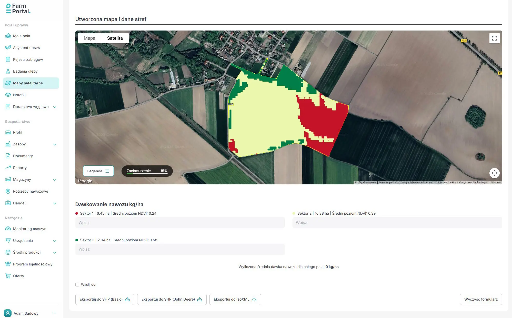
In FarmPortal you can generate maps with multiple indices (e.g., NDVI, NDRE, MSAVI), combine them with soil test results and field zones, and use the built-in fertilizer calculator to compute precise N, P, K (and Ca/Mg) rates at grid or section level. Finished variable-rate application maps can be exported directly to machine terminals in common formats (e.g., ISO-XML, SHP), so the operation can be executed immediately without additional manual data preparation.

