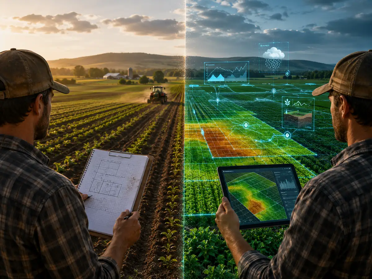
Summary
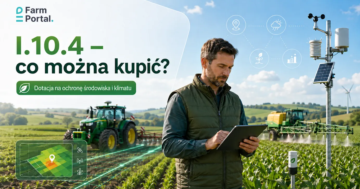
A farmer asking what can be purchased under I.10.4 usually has a machine, a weather station, GPS guidance or a sprayer in mind. The better question is: what environmental and production problem should the purchase solve, and how will the decisions, data and results be documented on the farm?
As at 18 June 2026: this article discusses the catalogue of eligible purchases and shows how FarmPortal can bring order to data from fields, machines, sensors, crop treatments and reports. It does not replace the current ARiMR rules or an individual assessment of eligibility.
At a glance
Intervention I.10.4 is a support instrument for on-farm investments that finance solutions reducing the environmental pressure of agricultural production, improving the management of water, fertilisers and plant protection products, and supporting adaptation to climate change.
- Under I.10.4, farmers may consider, among other things, grants for machinery, software, weather stations, sensors, agricultural GPS systems, sprayers and solutions for precision fertilisation.
- The safest purchase list starts with the problem: overlapping spray passes, lack of local weather data, uneven fertilisation, drought, poor documentation or the risk of errors during treatments.
- Equipment alone does not create order. In practice, decisions, application rates, fields, operators, maps and the history of activities still need to be recorded.
- FarmPortal can act as the digital layer of the project: it connects data from fields, sensors, machines, application maps and treatment records.
What is I.10.4 and when does a purchase make sense?
I.10.4 “Investments contributing to environmental and climate protection” is an intervention under the Strategic Plan for the Common Agricultural Policy 2023–2027. According to ARiMR information, support may be applied for by a farmer or a group of farmers, while the holding should meet, among other things, the condition of having no more than 300 ha of agricultural land and carrying out agricultural activity.

The biggest mistake with this grant is building a project around a catalogue of equipment. A farmer sees “grant for agricultural GPS” and immediately asks for an offer. In fact, the correct order is the reverse: first the problem, then the process, then the equipment, and only at the end the documentation.
The argument is simple: a machine on its own is not yet an environmental investment. It only becomes one when it reduces specific losses, input use, passes across the field, spray drift, fertilisation errors or weather risk, and when the farm can show that this is how it uses the machine.
ARiMR states that the maximum amount of aid for a beneficiary under I.10.4 during the CAP Strategic Plan period is PLN 200,000, usually up to 65% of eligible costs, and, in the case of a group of farmers and for certain purchases, up to 80% of eligible costs. The current conditions should always be checked in the official ARiMR description of intervention I.10.4.
In practice, this means that for a project worth PLN 120,000 net, the farmer should not ask only about reimbursement. The right question is whether the purchase makes sense given the farm’s scale, crops, machinery fleet, data quality and the actual decisions made from March to October.
What can be purchased under I.10.4?
What can be purchased under I.10.4? In simple terms: solutions that fall within the current investment catalogue and help reduce the use of fertilisers, plant protection products, emissions, water losses or the impact of adverse weather conditions. The catalogue is broad, but it is not unrestricted.
Among the investments that are particularly relevant to arable and horticultural farms are programmes for fertilisation and spraying application maps, programmes supporting fertilisation and crop protection planning, on-board computers for rate control, yield mapping systems, agricultural drones, devices for measuring plant nitrogen status, agricultural weather stations with software and sensors, and parallel guidance and automatic machine steering systems.
This is good news for farms that want to combine a grant for precision fertilisation, a grant for on-farm sensors and the purchase of software. The bad news is that a random set of “weather station plus app plus GPS” may look attractive commercially, but without a clear description of the process it is weak as a project.
The list of investment types also includes machinery for applying mineral fertilisers, solutions for variable-rate application using digital field maps and GPS signals, machines for applying natural fertilisers, selected sprayers that reduce drift or overlaps, equipment for water retention and water management, soil protection equipment and selected systems for livestock production. A detailed description of the scope is also published by the Ministry of Agriculture and Rural Development in its information on I.10.4.
How should precision agriculture be matched to the farm’s problem?
Funding for precision agriculture makes the most sense when equipment, data and decisions form one workflow. The weather station should feed treatment decisions, GPS should reduce overlaps, application maps should control the rate, and the FMS should record what was actually carried out.
On many farms, treatment data is created three times: first in the operator’s head, then on a piece of paper in the tractor cab, and later in a notebook or spreadsheet in the evening. At the third rewrite, the product batch number, the exact block or the treatment time is often lost. That is not a minor detail. In crop protection, the absence of the hour and weather conditions can change the assessment of the whole decision.
This is why the purchase list should include the process. For a grant for a farmer’s weather station, the process may be: measuring temperature, humidity, rainfall, wind and leaf wetness; issuing a frost alert; assessing the treatment window; entering the treatment in FarmPortal; and later generating a report on the decision history.
The same applies to a grant for agricultural GPS. Guidance without maps and records is just more convenient driving. Guidance combined with a field map, variable-rate application and machine work records already shows a reduction in overlaps, passes and operator errors.
Which purchases match specific objectives?
The best I.10.4 purchase list is not a wish list. It is a dependency map: the farm’s problem, the purchase, input data, the environmental effect and the way it will be documented during the season.
| Problem on the farm | Purchase to consider | Data needed for the decision | Effect to describe | How FarmPortal helps |
|---|---|---|---|---|
| Lack of local weather data | Agricultural weather station, sensors, software | Temperature, humidity, rainfall, wind, leaf wetness | Better spraying timing, frost alerts, fewer treatments in the wrong window | Assigning data to fields, alerts and decision history |
| Overlaps during spraying and fertilisation | Agricultural GPS, auto-steering, section control | Field boundaries, tramlines, application maps, working speed | Fewer passes, fewer overlaps, more stable application rates | Register of fields, treatments, maps and machine work |
| Uneven fertilisation | VRA spreader, fertilisation maps, nitrogen sensors | Soil tests, NDVI, nutrient status, fertilisation plan | Precision fertilisation and reduced nutrient losses | Fertilisation calculator, maps, rate history |
| Spray drift | Low-drift, sensor or recirculating sprayer | Weather conditions, BBCH stage, rate, product, block | Lower spray losses and better treatment control | Treatment plan, product records, application conditions |
| Drought and uncertain irrigation | Retention tanks, soil moisture sensors, water systems | Soil moisture, rainfall, crop stage, water requirements | Better water management and irrigation decisions | Field monitoring, alerts and agronomic notes |
How does FarmPortal support an I.10.4 project?
FarmPortal should not be added to the project simply as a “farm app” without justification. Its strength lies elsewhere: in organising the data that explains why the purchase of a machine, weather station, sensors or GPS system makes operational sense.
Within the FarmPortal functions for farms, the elements that matter most for I.10.4 are fields and crops, treatment records, the fertilisation calculator, satellite images, weather data, machine monitoring, weather stations, irrigation sensors, input stock management, reports and documentation. These are not separate islands. They work best when an entry from the field later supports a decision, a settlement and a report.
Example: a weather station detects frost risk or conditions favourable to disease. The adviser plans a treatment. The operator carries out the spraying. FarmPortal records the field, block, product, rate, date, operator and conditions. The same entry can later be used for cost analysis, crop protection history, withholding period control and a discussion with the raw material buyer.
For farms working with processors, it is worth thinking more broadly. Data from FarmPortal can feed FoodPass, the traceability, quality and supply-chain collaboration layer. The farmer documents production more effectively, while the raw material buyer gains visibility of batch history, origin and agronomic activities.
| Project element | Equipment purchased separately | Equipment connected with FarmPortal | Risk during inspection or seasonal analysis |
|---|---|---|---|
| Weather station | Data in the device manufacturer’s panel | Data assigned to fields and treatment decisions | It is harder to show the link between measurement and decision |
| Agricultural GPS | More precise driving, but limited operational history | Field boundaries, machine work and maps in one system | No full path from plan to execution |
| Precision fertilisation | Application map as a one-off file | Soil tests, NDVI, fertilisation plan and rates in the field history | It is unclear where the rate came from and whether it was applied |
| Sprayer | A technical purchase without the full treatment context | Plan, product, crop stage, operator, conditions and withholding period | Gaps in crop protection records |
If the project includes sensors and devices, it is also worth reviewing the page on sensors and devices integrated with FarmPortal. It is a good starting point for a discussion about weather stations, soil sensors, navigation systems, GPS monitoring and the data needed for on-farm decisions.
Benefits for farmers, advisers and producer groups
For the farmer, I.10.4 is an opportunity to purchase technology that is often postponed: a better sprayer, a guidance system, a weather station, sensors, fertilisation maps or water-related equipment. The biggest benefit appears when these elements shorten day-to-day decision-making, not when they merely appear in an offer as “technology”.
For the agronomic adviser, the value is different. The adviser does not have to guess whether a given treatment was carried out in acceptable wind conditions, whether the operator drove through the right block or whether the fertiliser rate matched the map. They see the data and can discuss the decision rather than memories from the field.
For a producer group, a joint purchase may be financially attractive, especially where high-class equipment would be too expensive for a single farm. But a joint purchase without usage rules, scheduling, work settlement and field data quickly turns into a dispute over timing. An FMS reduces that friction.
For a processor or raw material buyer, farm data is increasingly valuable. This is not just about a neat report. It is about being able to document origin, treatment history and raw material quality, especially when working with many growers.
Model example: a fruit and vegetable farm
Model example prepared for the purposes of this article. The data is used to illustrate the process and requires verification before being used as the result of an actual implementation.
The farm manages 42 ha of production: 18 ha of orchard, 9 ha of strawberries and 15 ha of field vegetables. The problem is not a lack of work. The problem is decision chaos in May and June, when crop protection, fertilisation, irrigation, scouting and harvest preparation are all happening at the same time.
The model purchase list includes an agricultural weather station with sensors, soil moisture sensors at two sites, a parallel guidance system with map support, a software licence for record-keeping and fertilisation maps, and retrofitting the sprayer with solutions that reduce overlaps. The total net value of the project is PLN 146,000. At an aid level of up to 65%, the indicative reimbursement would be PLN 94,900, provided the scope and costs were deemed eligible.
| Element | Net amount | Production objective | Data in FarmPortal |
|---|---|---|---|
| Weather station with sensors | PLN 28,000 | Treatment windows, frost alerts, disease risk | Weather assigned to fields and alerts |
| Soil moisture sensors | PLN 18,000 | Irrigation decisions and water management | Moisture history and agronomic notes |
| GPS and map support | PLN 52,000 | Fewer overlaps, more precise passes | Field boundaries, tramlines, machine work |
| Software and fertilisation maps | PLN 24,000 | Precision fertilisation and rate documentation | Soil tests, NDVI, rates, reports |
| Sprayer retrofit | PLN 24,000 | Reduced spray overlaps and better treatment control | Treatments, products, withholding periods, operators |
A model KPI for this kind of farm should not be “equipment purchased”. It should be: the number of treatments recorded with weather conditions, the share of fields with a fertilisation map, the number of frost alerts handled in the application, the number of treatments with complete product and rate records, and the number of machine operations assigned to a field.
Own editorial benchmark for the process: on a farm that carries out 50–80 crop protection and fertilisation treatments per season, even 5 minutes saved on one complete entry means 4–7 hours less administrative work. This is an indicative figure, but it points in the right direction: digitalisation does not save time because it is “digital”. It saves time when the same entry is not rewritten three times.
When will the grant not solve the problem?
A grant will not fix a poor process. If no one on the farm updates field boundaries, records treatments, enters stock levels or agrees the work plan with the operator, even the best weather station will become another panel checked once a week.
Not every purchase makes sense at every scale. A drone, a nitrogen sensor or an advanced sensor sprayer may be justified on a farm with many plots, high-value crops and a repeatable process. At a smaller scale, a proper record system, a weather station and a well-prepared fertilisation plan may deliver a better result.
Buying devices without integration is also risky. Data in one panel, maps in another system, treatments in a notebook, invoices in a binder and fields in a file copied from an e-application create only the appearance of digitalisation. On the day of an inspection or audit, all of this has to be stitched together manually.
FarmPortal’s practical recommendation is to build the project in three layers. The first layer is equipment and sensors. The second is software and data integration. The third is the farm’s working procedure: who enters the treatment, who approves the plan, who responds to an alert and where the report is created.
FAQ
What can be purchased under I.10.4 on a farm?
Under I.10.4, funding may cover investments from a closed catalogue that reduce the farm’s environmental pressure or help adapt production to climate change. In practice, these include machinery for fertilisation and crop protection, weather stations, GPS systems, software, water retention equipment and selected solutions for livestock production.
Can a grant for a farmer’s weather station include sensors and software?
Yes. The list of investment types includes agricultural weather stations together with software and measuring sensors. Before purchasing, the current rules and eligibility scope should be checked, and the applicant should justify how data from the station supports production decisions, for example crop protection, irrigation or reducing weather-related losses.
Does funding for precision agriculture include agricultural GPS?
Yes. The I.10.4 catalogue includes parallel guidance and automatic steering systems for tractors or machines, as well as on-board computers and equipment for controlling the precise application rate of fertilisers, seeds and plant protection products. The GPS purchase itself should be linked to a specific process, such as variable-rate fertilisation or overlap reduction.
What is the level of aid under I.10.4?
According to ARiMR information, the maximum aid for a beneficiary during the CAP Strategic Plan 2023–2027 period is PLN 200,000. The standard aid level is up to 65% of eligible costs, and, for a group of farmers and selected machinery, equipment and intangible investments, it may be up to 80%. The minimum operation value and the current rules should also be checked.
Can a sprayer be purchased with grant funding?
Yes, provided the sprayer falls within the investment catalogue and is intended to reduce the use or drift of plant protection products. Examples include sprayers with a drift reduction class, recirculating orchard sprayers, sensor sprayers and solutions that prevent overlaps of spray liquid on curved sections of a field.
Can FarmPortal be included in an I.10.4 project?
FarmPortal may be considered as the digital element of a project if the investment scope matches the rules and is connected with production decisions, documentation or the integration of data from machines, sensors and fields. This should not be treated as automatic eligibility. The final fit must be checked against the current rules, with an adviser and in the description of the operation.
How should a purchase list for I.10.4 be prepared so it is not random?
First describe the production problem: excessive spray overlaps, uneven fertilisation, lack of weather data, drought risk or delayed treatment decisions. Only then select the equipment: a weather station, GPS, application maps, sensors, a sprayer or a spreader. Finally, add how the data will be documented in a system such as FarmPortal.
Is the machine alone enough to demonstrate an environmental effect?
Not always. A machine may reduce the use of fertilisers or plant protection products, but without data it is difficult to demonstrate this. In practice, it is worth combining equipment purchases with treatment records, application maps, field history, weather data and reports. This makes the project description more coherent and gives the farm material for inspection and seasonal analysis.
Glossary
- I.10.4
- The intervention “Investments contributing to environmental and climate protection” under the CAP Strategic Plan 2023–2027. In practice, it concerns purchases and investments that have a justified link to agricultural production and an environmental effect.
- FMS
- Farm Management System, a system for managing a farm. FarmPortal, as an FMS, organises fields, treatments, machines, employees, stock, sensors, maps and reports.
- VRA
- Variable Rate Application, meaning the variable application of fertilisers, seeds or products according to an application map. Under I.10.4, it is particularly relevant to precision fertilisation and reducing nutrient losses.
- NDVI
- Normalized Difference Vegetation Index, a vegetation index calculated from satellite imagery. It helps identify differences in crop condition and prepare scouting or fertilisation decisions.
- Agricultural GPS
- A positioning and machine guidance system used in the field. In a precision version, it can reduce overlaps, improve pass accuracy and support variable-rate application.
- On-farm weather station
- A set of sensors measuring local weather conditions, such as temperature, rainfall, wind, humidity and leaf wetness. The data supports crop protection planning, irrigation and frost response.
- Application map
- A file or data layer indicating application rates for specific parts of a field. It may be based on soil tests, satellite imagery, yield maps or adviser recommendations.
- FoodPass
- An application within the FarmCloud ecosystem for traceability, quality, audits and supplier collaboration. Together with FarmPortal, it can help transfer production data into the supply chain.
Summary and next step
If you are wondering what can be purchased under I.10.4, do not start with a price list. Start with a list of losses and errors: overlapping passes, lack of local weather data, incomplete treatment records, uneven fertilisation, late irrigation, documentation problems or weak machine control.
Only then select the technology. On one farm it may be a weather station and soil sensors. On another, agricultural GPS and application maps. On a third, a low-drift sprayer, precision fertilisation and full records in FarmPortal.
Practical next step: prepare a single table with five columns: problem, purchase, input data, environmental effect, documentation method. This kind of table will show whether the project is coherent more quickly than another equipment list copied from a catalogue.
Would you like to check whether FarmPortal fits your project?
If you are planning an I.10.4 project involving a weather station, agricultural GPS, sensors, precision fertilisation, a sprayer or treatment documentation, prepare a short description of the farm and a list of planned purchases. The FarmPortal team can help translate them into a data process that is clear for the farmer, the adviser and the person assessing the coherence of the project.
Follow us!
See what we're doing and be inspired by positive changes.